XSLT is used in
We are prepared to transform your hydrographic data into a web-based Hydrographic Database Management System with GIS tools (HIS).
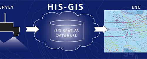
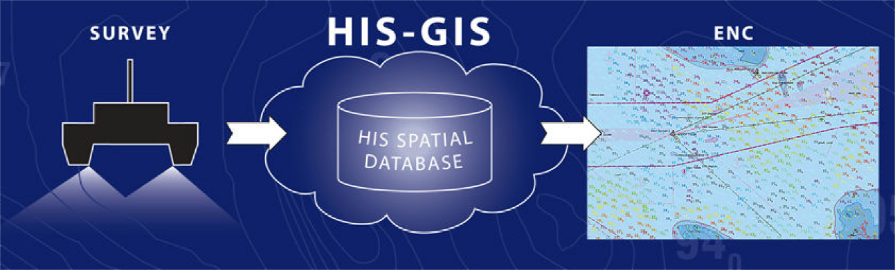
HIS is an information system for managing and presenting data from hydrographic surveys.
It can also produce high quality fairsheets to simplify the process of the production of electronic navigational charts.
Maritime safety
Hydrographers and Cartographers can take decisions based on location information. It is a vital feature considering the constant changing of the underwater situation.
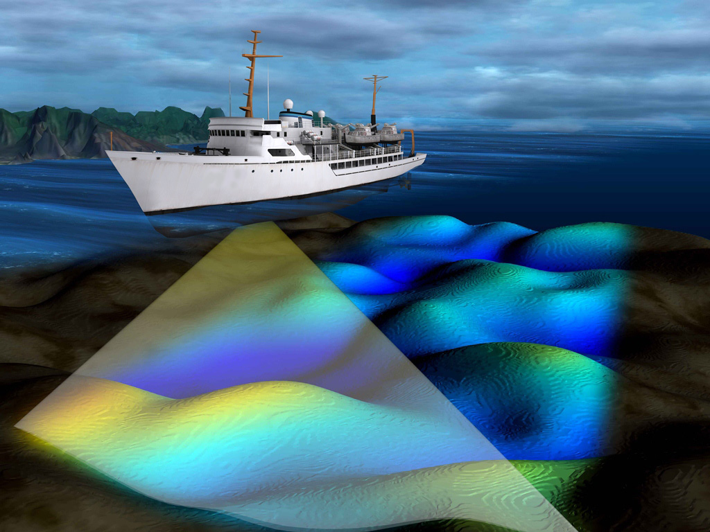
The system consists of two main parts: a seamless database of depths (soundings) and a database of objects. The objects for the system are collected from hydrographic surveys – survey areas, wrecks, navigational marks, rocks and obstructions.
For every object extensive information can be stored in HIS, containing its location, classification and attributes, and also images. HIS also provides a wide range of user-friendly GIS management tools for managing and presenting surveyed data.
Estonian Transport Administration
Url: www.transpordiamet.ee/en
The principal aim of Maritime Administration is to ensure safe navigation in territorial and inland waters.