Supporting all the phases of the mine hunting operations: planning, operation and reporting. The data handling and data exchange of the detected, classified and identified sonar contacts is entirely based on the NATO AML-SBO (Additional Military Layers, Small Bottom Objects) electronic chart concept.
Minehunting operations and information system
Mission critical
Highly reliable information system

Risto Saimla, naval lieutenant
Based on the experience with R-Systems Ltd since 2011, we are confident that they live up to the commitment, and deliver working solution in a proactive and flexible manner
techincal
- Data input sensors: Minehunting sonar Plessey 193M, up to two GPS/DGPS units, Gyro, LOG, CTDprobe, ORE Trackpoint, Side scan sonar (contacts)
- Hardware: 19" rack mounted computer unit, UPS. 18" flat colour display, secondary display. Sonar Plessey 193M interface unit.A3 colour printer, A4 line printer.Video image digital converter (Sensoray)
- Software environment: RedHat / Fedora Linux, X-Windows, Motif, Gnome Desktop Environment
Complex data processing
- Mission planning and preparation. Different plan types - Route Survey, Area Survey, Lost Object and Mine Exercise. Sonar Condition Check support.
- Surveying / mine hunting. Control of operational mission. Real-time mission evaluation. Task management.
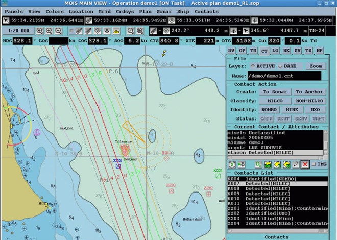
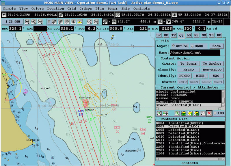
- Sensor data processing. Exact geographical positioning of ship and sonar contacts using incoming data from navigation sensors. Sonar contact position correction using Sound Velocity Profile.
- Operation data presentation. Graphical presentation of background charts, known contacts database, ship position and trajectory, sensor positions, sonar searching sector and focus, operation plan, tracks and detected sonar contacts. Numeric display of navigation data, tidal streams, track information, sonar contact position and distance vectors.
- Supplementary data presentation. AML v 2.0 charts. IHO S57 / S52 electronic charts. S63-protected IHO charts.
- Geographical grid systems, including Baltic Ordnance Grid – BOG. Transverse Mercator coordinate system – TM / UTM.
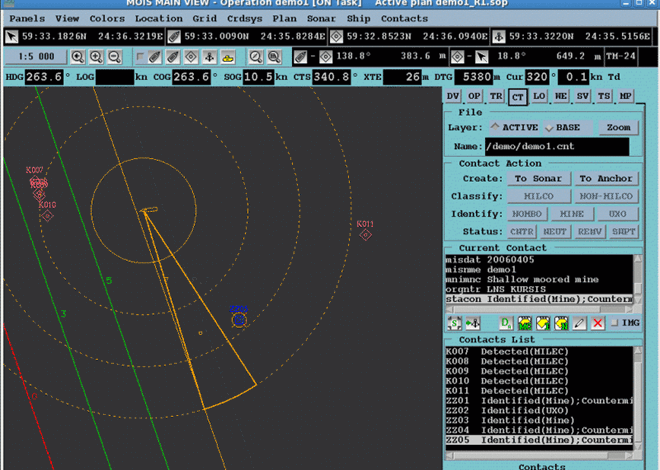
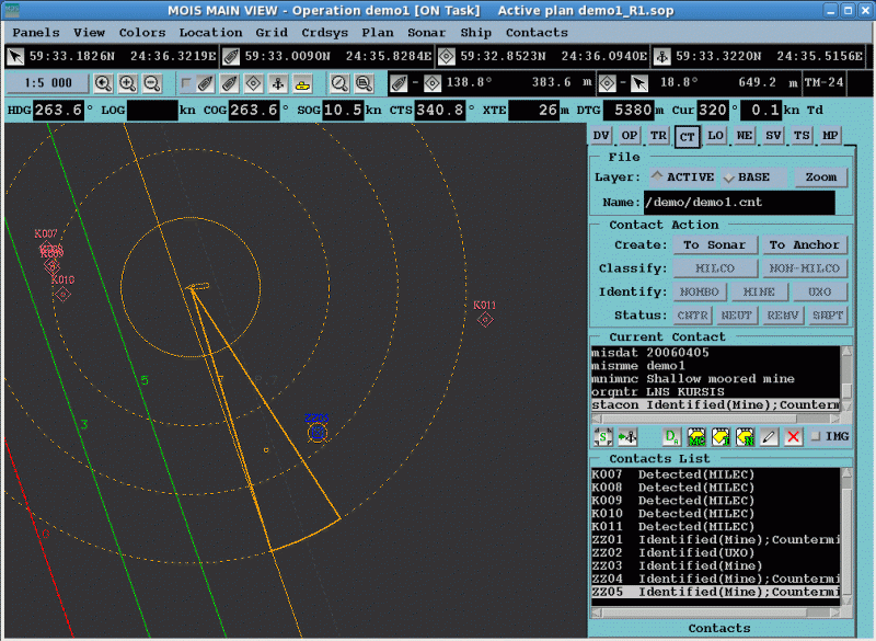
- Sonar contacts processing. Identification and classification of detected sonar contacts based on the AML-SBO concept. Automated attribute values assignment. Contact/mine datasets management.
- Remote Operating Vehicle support. PAP (Poison Auto Propulsé) position tracking. Underwater TV image digital recording and binding with sonar contacts.
- Navigation objects editing. Editing of custom chart using S57 objects.
- Data records. Recording of contacts, events, operation status, ship movement and weather reports. Display and analysis of recorded data.
- Report generation. On-line events log printing. Contact and operation reports, color area plots A3/A4. FORMEX 187 type contact report. Weather reports, sound velocity profiles.
- Data exchange. AML and S57 input, AML SBO output. AML and custom file formats. Side scan sonar contacts import.
- Ergonomics. User friendly Man-Machine Interface (MMI) using windowing techniques and fast access function keys. Separate windows/displays for active mission control and for off-line functions - planning, display of recorded data and reporting. Switching the MMI colors according to light conditions (day / night)
Mission planning and preparation. Different plan types - Route Survey, Area Survey, Lost Object and Mine Exercise. Sonar Condition Check support.
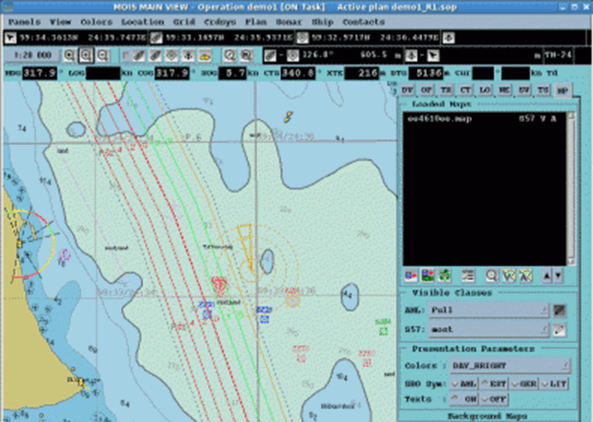
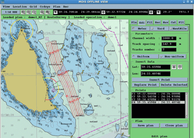 Editing the survey plan and course
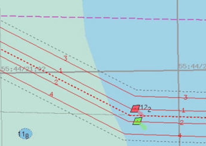
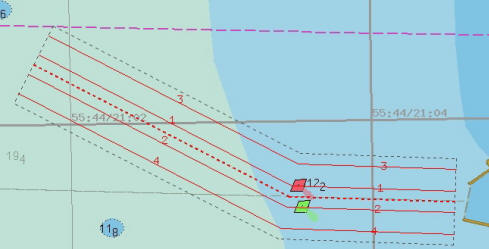
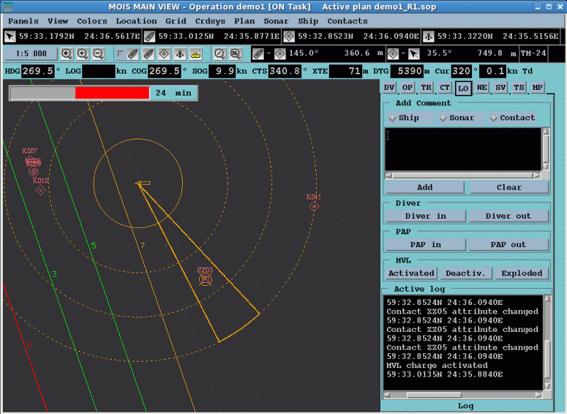
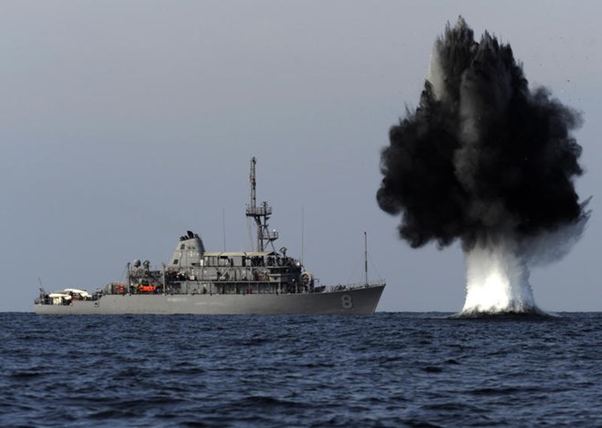 Mine neutralization by remote detonation of a mine disposal charge
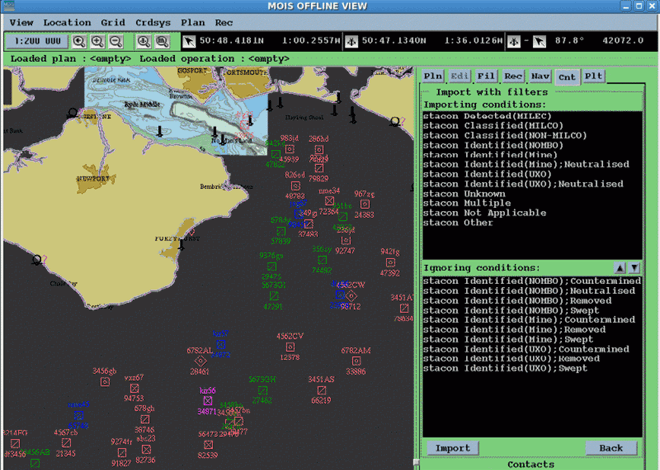
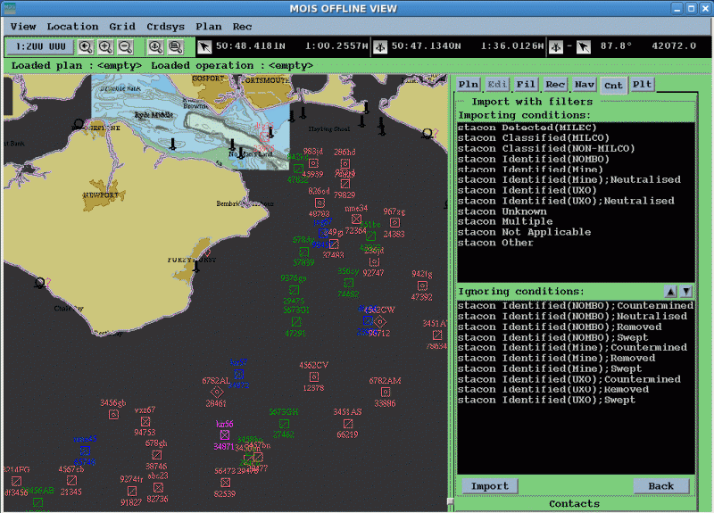
- NATO (AML) Additional Military Layers (SBO) Small Bottom Objects military sea charts
- Estonian set
- Lithuanian set
- German set
- Any other custom set
 German set
 Lithuanian set
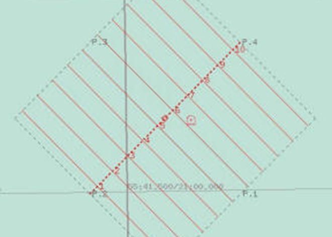
 Route survey
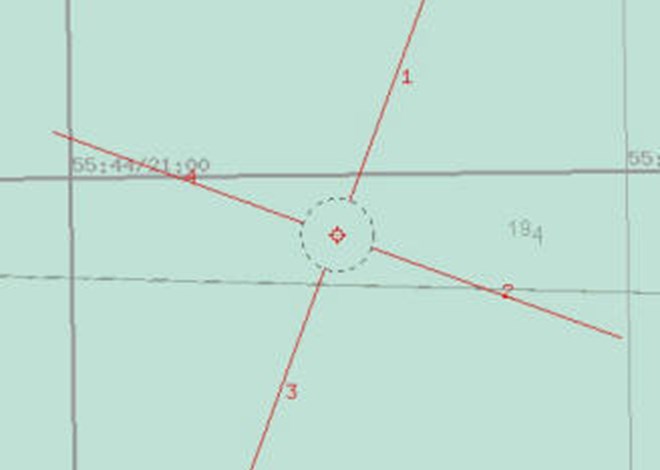
 Lost object
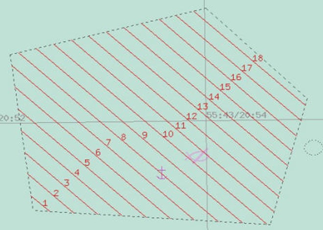 Area survey
 Exercise-Mine
- NATO AML charts
- S57 navigation charts
- Known objects in the area, data from Mine Warfare Data-Centre
- Navigation objects
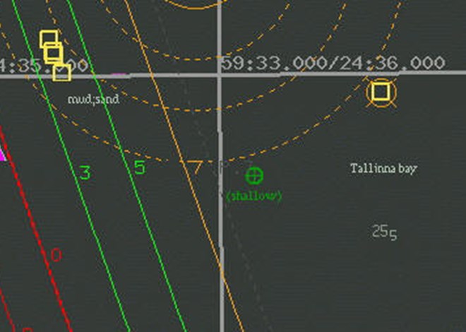
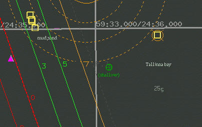
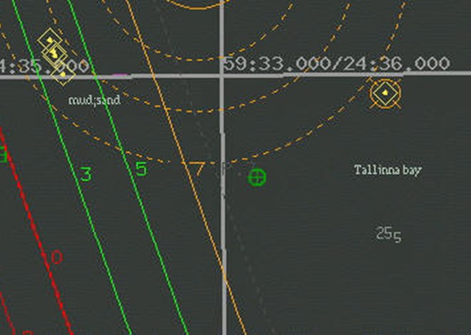
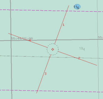
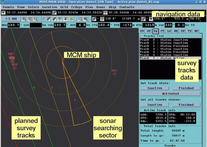
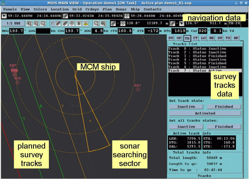
 Searching for sonar contacts (mine-like bottom objects)
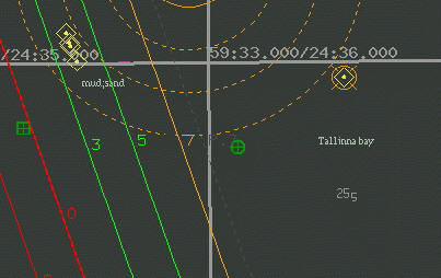
 Navigation parameters graphical and numeric presentation
 Day skin
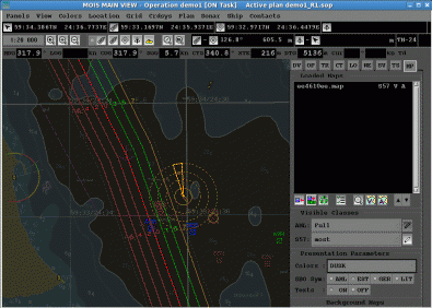
 Night skin
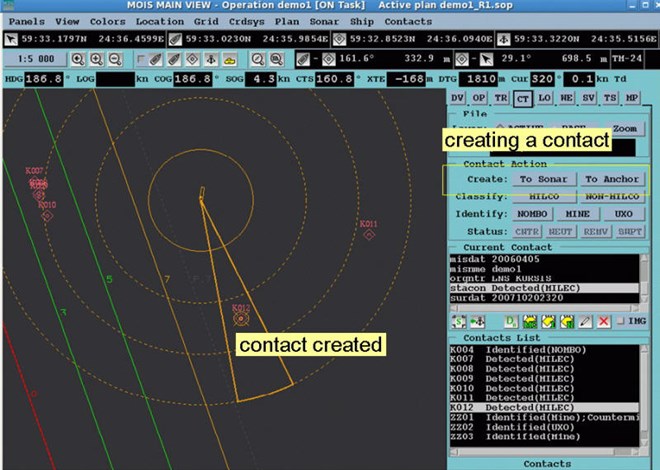 1. Creating a new object
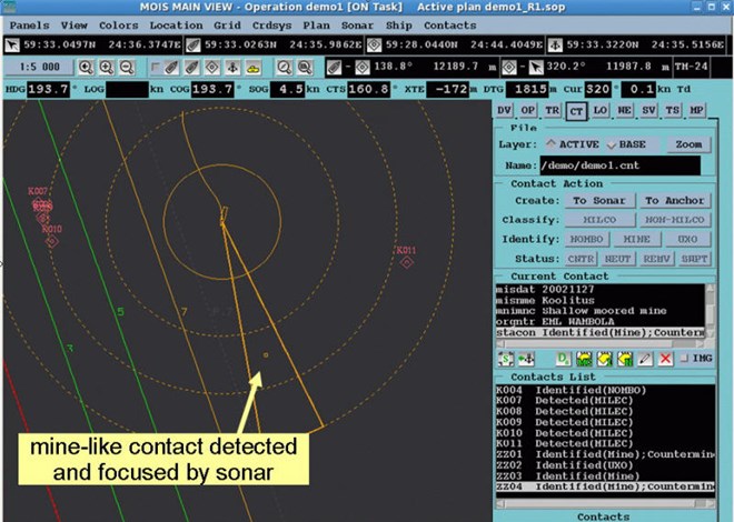 2. Positioning objects detected and focused by sonar
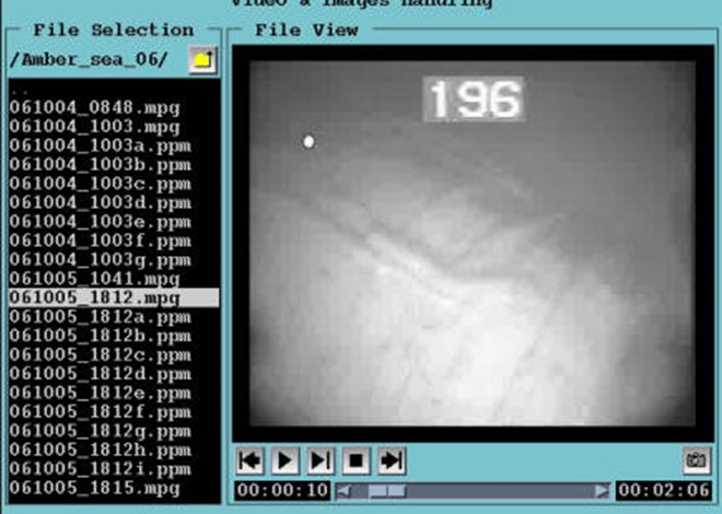 3. Handle online images from underwater cameras (divers, robots)
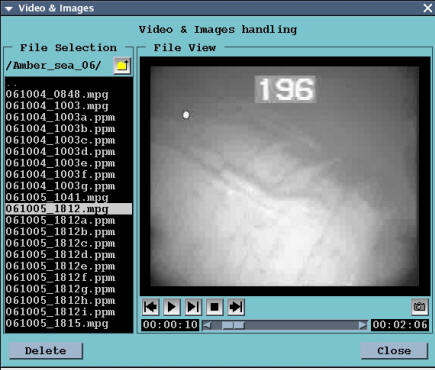
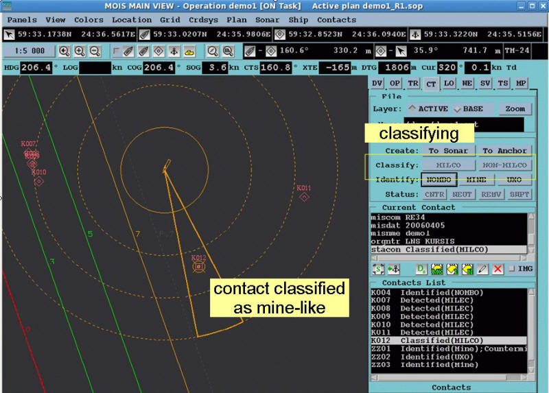
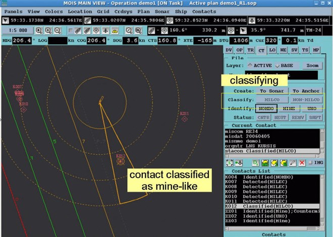 4. Classifying objects to mine-like or non mine-like
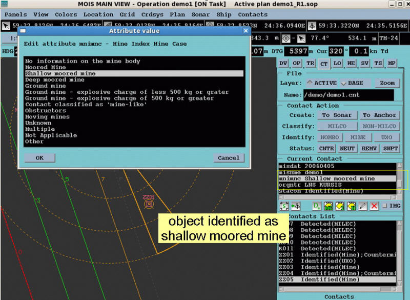
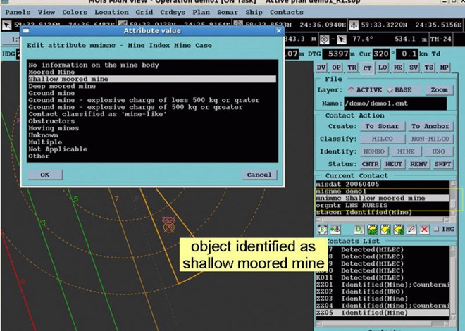 5. Updating attributes of identified objects
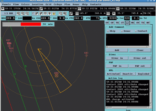 6. Mine disposal: charge countdown
 7. Changing the status of a neutralized object to “countermined”
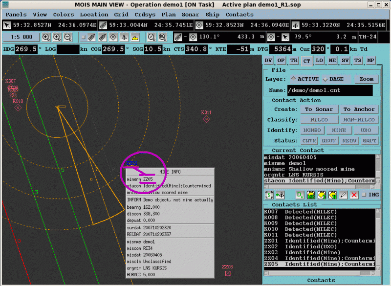
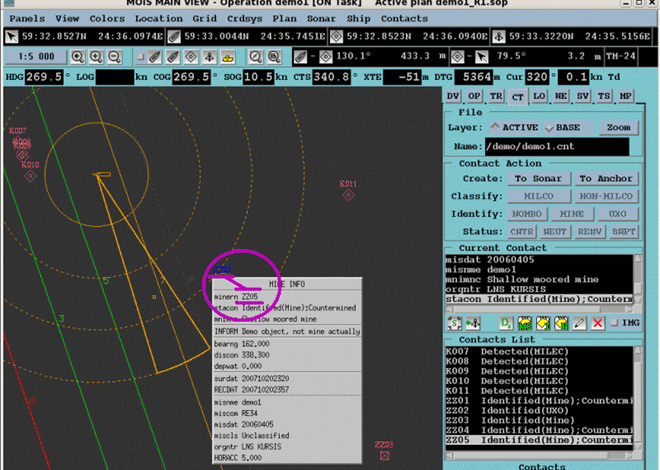 8. View pointed-object properties - Popup window
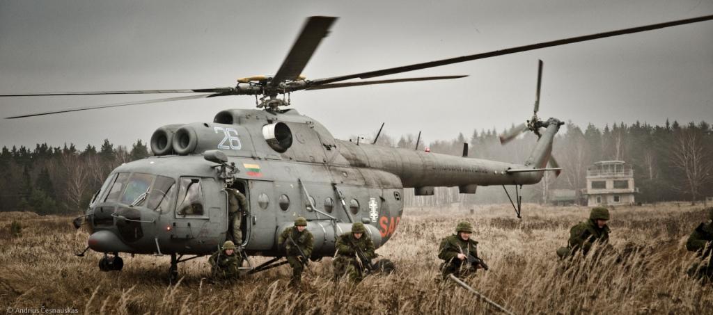
Estonian Defence Forces
Url: www.mil.ee
Estonia's defence policy aims to guarantee the preservation of the independence and sovereignty of the state, the integrity of its land area, territorial waters and airspace and its constitutional order.